Index
Allalinhorn, 4027m
Alphubel, 4206m
August 1999

Gallery
Previous

Slide
Slide 2 Next

Slide

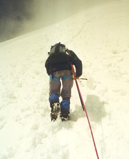
Maya on the final approach to the summit of Alphubel, 4206m
We went to Alphubel from Feejoch over the ridge to Feechopf (3888m) and then down across a large plateau called Alphubeljoch located about 500 vertical meters just below the summit. While crossing Alphubeljoch we met a large group of climbers coming down. Visibility was still very poor. The trail, however, was hard to miss. Finally, when we crossed Alphubeljoch and started going up on a steep ridge the weather got better. All of a sudden we could see all the high mountains around us: Rimpfischhorn, Alphubel, and Allalinhorn. This photo was taken on the final approach to the top, where the slopes get to be 45 degrees plus. Our excellent Alpine guide mentioned that this was the only difficult part in case one ends up walking on ice. It now was an early afternoon, rather warm, and there was no ice. In fact snow condition were excellent and final ascent presented no objective danger. It was very steep though. We were on the top at about 3 p.m. The summit of Alphubel is a flat, large snow field. In fact, it is even hard to guess where the highest point is. The familiar cross, typically found on most of the higher summits in the Swiss Alps is not there. Now, the weather was almost perfect but it was getting very late. After a short discussion we decided to descend the same way we came. Our original plan was to cross the Feegletscher glacier on the way down to Längflue. However, a long glacier walk in the warmth of the afternoon sun was not something we were particularly excited about. Yet, we were to end up at Längflue anyway.